NESP TWQ Project 5.10 - Development and application of automated tools for high resolution gully mapping and classification from LiDAR data, 2019-2020 (GU)
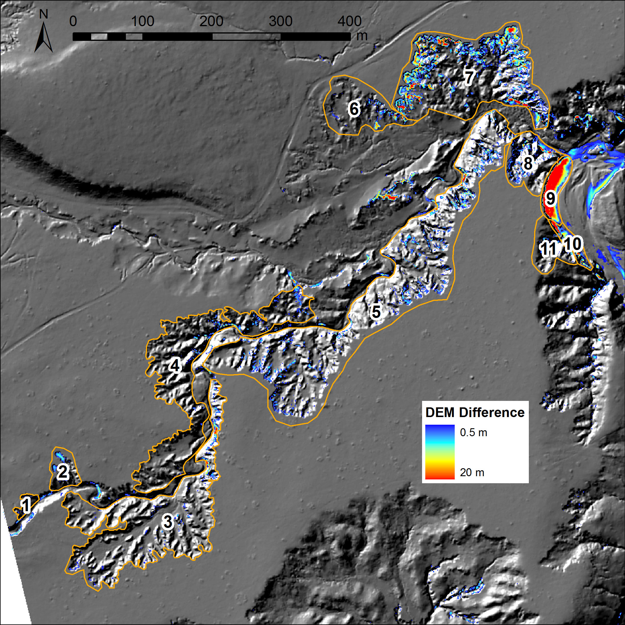
Accurately mapping gullies at high resolution and quantifying their key attributes is the critical first step in the process of prioritising and designing rehabilitation solutions. At least 40% of the accelerated erosion that is contributing to poor water quality in the Great Barrier Reef (GBR)Lagoon is sourced from gully erosion, demanding effective management and rehabilitation of these features. Current gully maps across the GBR are low resolution and overly simple,providing no differentiation between gully type. Airborne Light Detection And Ranging (LiDAR) is now widely recognised as being the best way to accurately map gullies at a landscape scale at a suitable resolution for management planning. Given the large volume of LiDAR data now becoming available, this project will develop and apply automated tools to enable the location of gullies to be extracted from LiDAR Digital Elevation Models (DEMs), along with key attributes of the gullies enabling them to be grouped into classes of similar gully types to aid prioritisation, management and catchment modelling.
Simple
- Date (Creation)
- 2019-01-22T00:00:00Z
Identifier
- Cited responsible party
-
Role Organisation Name Telephone Delivery point City Administrative area Postal code Country Electronic mail address Principal investigator Griffith University Brooks, Andrew andrew.brooks@griffith.edu.au Collaborator Griffith University Spencer, John Collaborator Griffith University Curwen, Graeme Collaborator Queensland Department of Environment and Science Tindall, Dan Collaborator Queensland Department of Environment and Science Goodwin, Nick Collaborator Griffith University Daley, James Collaborator Griffith University Stout, Justin
- Credit
- This project was funded by the Australian Government's Department of Agriculture, Water and the Environment through the National Environmental Science Programme Tropical Water Quality (NESP TWQ) hub with co-investment from project partners and collaborators.
- Status
- complete
- Point of contact
-
Role Organisation Name Telephone Delivery point City Administrative area Postal code Country Electronic mail address Point of contact Griffith University Brooks, Andrew andrew.brooks@griffith.edu.au
- Topic category
-
- Environment
Extent
Extent
- Description
- Project extent

Temporal extent
- Time period
- 2019-01-01 2020-12-10T00:00:00Z
- Keywords (dataSource)
-
- National Environmental Science Programme Tropical Water Quality (NESP TWQ) hub
- Keywords (Theme)
-
- marine
Resource constraints
- Classification
- Unclassified
Resource constraints
- Linkage
-
http://i.creativecommons.org/l/by/4.0/88x31.png
License Graphic
- Title
- Creative Commons Attribution 4.0 International License
- Cited responsible party
-
Role Organisation Name Telephone Delivery point City Administrative area Postal code Country Electronic mail address Principal investigator
- Website
-
http://creativecommons.org/licenses/by/4.0/
License Text
- Language
- English
- Character encoding
- UTF8
Distributor
- Distributor contact
-
Role Organisation Name Telephone Delivery point City Administrative area Postal code Country Electronic mail address Publisher Australian Institute of Marine Science eAtlas Data Manager Voice PRIVATE MAIL BAG 3, TOWNSVILLE MAIL CENTRE Townsville Queensland 4810 Australia e-atlas@aims.gov.au
- OnLine resource
- Project page
- OnLine resource
- NESP TWQ Hub
- OnLine resource
- Department of Climate Change, Energy, the Environment and Water - National Environmental Science Program website
- OnLine resource
- Project photo gallery
Metadata
- Metadata identifier
- urn:uuid/34bf260a-2d10-4222-a304-881f4104d8dd
- Language
- English
- Character encoding
- UTF8
- Contact
-
Role Organisation Name Telephone Delivery point City Administrative area Postal code Country Electronic mail address Point of contact Australian Institute of Marine Science (AIMS) eAtlas Data Manager Voice PRIVATE MAIL BAG 3, TOWNSVILLE MAIL CENTRE Townsville Queensland 4810 Australia e-atlas@aims.gov.au
Type of resource
- Resource scope
- Field session
- Name
- NESP TWQ Project 5.10
- Metadata linkage
-
https://eatlas.org.au/data/34bf260a-2d10-4222-a304-881f4104d8dd/
Point of truth URL of this metadata record
- Date info (Creation)
- 2024-02-05 00:00:00
- Date info (Revision)
- 2026-06-25T08:15:10.508Z
Metadata standard
- Title
- ISO 19115-3:2018
Overviews
Spatial extent

Provided by
