eAtlas Data Catalogue
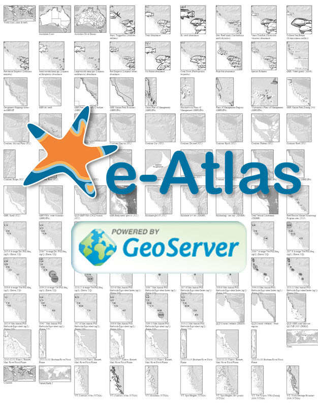
eAtlas Web Mapping Service (WMS) (AIMS)
The eAtlas delivers its mapping products via two Web Mapping Services, a legacy server (from 2008-2011) and a newer primary server (2011+) to which all new content is added. This record describes the primary WMS.
This service delivers map layers associated with the eAtlas project ( https://eatlas.org.au), which contains map layers of environmental research focusing on the Great Barrier Reef and its neighbouring coast, the Wet Tropics rainforests and Torres Strait. It also includes lots of reference datasets that provide context for the research data. These reference datasets are sourced mostly from state and federal agencies. In addition to this a number of reference basemaps and associated layers are developed as part of the eAtlas and these are made available through this service.
This services also delivers map layers associated with the Torres Strait eAtlas.
This web map service is predominantly set up and maintained for delivery of visualisations through the eAtlas mapping portal ( https://maps.eatlas.org.au) and the Australian Ocean Data Network (AODN) portal ( http://portal.aodn.org.au). Other portals are free to use this service with attribution, provided you inform us with an email so we can let you know of any changes to the service.
This WMS is implemented using GeoServer version 2.13 software hosted on a Amazon Web Services (AWS) server. Associated with each WMS layer is a corresponding cached tiled service which is much faster then the WMS. Please use the cached version when possible.
The layers that are available can be discovered by inspecting the GetCapabilities document generated by the GeoServer. This XML document lists all the layers, their descriptions and available rendering styles. Most WMS clients should be able to read this document allowing easy access to all the layers from this service.
For ArcMap use the following steps to add this service:
1. "Add Data" then choose GIS Servers from the "Look in" drop down.
2. Click "Add WMS Server" then set the URL to " https://maps.eatlas.org.au/maps/wms?"
Note: this service has over 1500 layers and so retrieving the capabilities documents can take a while.
This services is operated by the Australian Institute of Marine Science and co-funded by the National Environmental Research Program Tropical Ecosystems hub.
Simple
Identification info
- Date (Publication)
- 2011-01-01T11:47:00
- Status
- On going
- Point of contact
-
Role Organisation Name Telephone Delivery point City Administrative area Postal code Country Electronic mail address Point of contact Australian Institute of Marine Science (AIMS) Lawrey, Eric, Dr Voice PRIVATE MAIL BAG 3, TOWNSVILLE MAIL CENTRE Townsville Queensland 4810 Australia e-atlas@aims.gov.au
- Spatial representation type
- Grid
- Topic category
-
- Biota
- Boundaries
- Elevation
- Planning cadastre
- Imagery base maps earth cover
Extent
Extent
))
- Keywords (Theme)
-
- Web Mapping Service
- WMS
- Web Mapping Tiled Service
- WMTS
- GeoServer
- GeoWebCache
- marine
Resource constraints
- Use limitation
- The imagery provided by this service is made available under a creative commons license. Attribution should be given to the eAtlas and the data providers of the layers. This layer information is available via the titles and the linked metadata records. If you use this service in an on-going service like a portal please send us an email so we can inform you of any potential changes to the service.
- Linkage
-
http://i.creativecommons.org/l/by/2.5/au/88x31.png
License Graphic
- Title
- Creative Commons Attribution 2.5 Australia License
- Cited responsible party
-
Role Organisation Name Telephone Delivery point City Administrative area Postal code Country Electronic mail address
- Website
-
http://creativecommons.org/licenses/by/2.5/au/
License Text
- Language
- English
- Character encoding
- UTF8
Distribution Information
Reference System Information
- Reference system identifier
- EPSG/EPSG:4326
Metadata constraints
- Linkage
-
http://i.creativecommons.org/l/by/2.5/au/88x31.png
License Graphic
- Title
- Creative Commons Attribution 2.5 Australia License
- Cited responsible party
-
Role Organisation Name Telephone Delivery point City Administrative area Postal code Country Electronic mail address
- Website
-
http://creativecommons.org/licenses/by/2.5/au/
License Text
Metadata
- Metadata identifier
- urn:uuid/71127e4d-9f14-4c57-9845-1dce0b541d8d
- Language
- English
- Character encoding
- UTF8
- Contact
-
Role Organisation Name Telephone Delivery point City Administrative area Postal code Country Electronic mail address Point of contact Australian Institute of Marine Science (AIMS) Lawrey, Eric, Dr Voice Facsimile PRIVATE MAIL BAG 3, TOWNSVILLE MAIL CENTRE Townsville Queensland 4810 Australia e-atlas@aims.gov.au
- Parent metadata
Type of resource
- Resource scope
- Service
- Metadata linkage
-
https://eatlas.org.au/data/uuid/71127e4d-9f14-4c57-9845-1dce0b541d8d
Point of truth URL of this metadata record
- Date info (Creation)
- 2020-10-23T03:58:59
- Date info (Revision)
- 2023-11-24T06:30:17
Metadata standard
- Title
- ISO 19115-3:2018