eAtlas Data Catalogue
Australian Maritime Boundaries (AMB) and Petroleum (Submerged Lands) Act 1967 (2006) - Superseded
Geoscience Australia has the primary role in the delineation of Australia's maritime boundaries. An output of this activity is the development of the Australian Maritime Boundaries (AMB) data. AMB is a GIS data product, replacing AMBIS 2001 Version 1.1, providing access to the data for Australia's Territorial Sea Baseline (TSB) and maritime zones.
Note: This is a non authoritative copy of the metadata for the use in the eAtlas. Please refer to Geoscience Australia for queries on this dataset. This version of the dataset is now superseded by the Seas and Submerged Lands Act 1973 - epoch AMB2014a dataset.
AMB is a digital representation of Australia's territorial sea baseline and boundaries as established under the Seas and Submerged Lands Act 1973. The data also include a representation of the limits by which the adjacent areas of each of the States and of the Northern Territory are determined under the Petroleum (Submerged Lands) Act 1967. In the event of an inconsistency between AMB data and the baseline and limits under the legislation, the latter prevails.
The data have been published by Geoscience Australia in consultation with other relevant Commonwealth Government agencies including the Attorney-General's Department, the Department of Foreign Affairs and Trade and the Australian Hydrographic Office.
AMB data comprise the TSB and the outer limits of each zone, together with maritime boundaries determined by treaties between Australia and neighbouring countries. Base points that generate the zone boundaries are supplied in separate files and an extensive user guide provides useful background information. All data coordinates are supplied in the World Geodetic System (WGS 84) (ITRF 2000 @ 2000.0) which is effectively identical to the GDA94 datum.
Geoscience Australia is committed to the maintenance of the maritime boundaries data to ensure it reflects the changing nature of Australia's coastline and hence the various maritime zone limits. The data reflects the location of the coastline within the constraints of available source material at the time of production. Where major differences have since been discovered, these are listed in a table of notes and cautions.
Note: This is a non authoritative copy of the metadata for the use in the eAtlas. Please refer to Geoscience Australia for queries on this dataset.
Simple
Identification info
- Date (Publication)
- 2006-01-01T00:00:00
- Edition
- v. 2.0
- Citation identifier
- 63565
- Citation identifier
- http://www.ga.gov.au/metadata-gateway/metadata/record/63565/
- Cited responsible party
-
Role Organisation Name Telephone Delivery point City Administrative area Postal code Country Electronic mail address Author
- Point of contact
-
Role Organisation Name Telephone Delivery point City Administrative area Postal code Country Electronic mail address Owner Commonwealth of Australia (Geoscience Australia) Custodian Commonwealth of Australia (Geoscience Australia)
- Topic category
-
- Geoscientific information
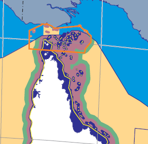
Extent
Extent
))
- Maintenance and update frequency
- As needed
- Keywords
-
- GIS Dataset
- Thematic
- Keywords (Theme)
-
- dataset
- National dataset
- GIS
- administrative boundaries
- marine jurisdiction
- Australian and New Zealand Standard Research Classification (ANZSRC)
-
- Earth Sciences
Resource constraints
- Access constraints
- Other restrictions
- Other constraints
- license
Resource constraints
- Use constraints
- License
- Use constraints
- Other restrictions
- Other constraints
- Creative Commons Attribution 3.0 Australia Licence
Resource constraints
- Classification
- Unclassified
- Language
- English
- Character encoding
- UTF8
Distribution Information
- OnLine resource
- Geoscience Australia metadata page for this dataset.
Resource lineage
- Statement
- The territorial sea baseline ('the baseline') data was originally derived from Geoscience Australia's 1:100 000 scale coastline data supplemented with coastal aerial photography in some areas. This mapping of the baseline was done in the early 1990's and since then the baseline data has been extensively validated and revised using the best available data from Geoscience Australia, the Australian Hydrographic Office and all State and Territory mapping agencies. The source material used for this purpose includes charts, topographic mapping, recent aerial photography and satellite imagery, as well as, other miscellaneous sources, such as LADS data. Australia's baseline incorporates approximately four hundred straight baselines as proclaimed under the Seas and Submerged Lands Act 1973. The location of the terminal points of these straight baselines were revised in 2005 to make them compatible with the Geocentric Datum of Australia (GDA94) as well as Geoscience Australia's most recent mapping of the baseline. These new locations of the straight baselines have been incorporated into the baseline for AMB. The various maritime limits that are derived as a distance from the baseline have been rigorously computed using specialises geodetic software rather than simple buffering. This software, known as MarZone was developed specifically for this purpose by the Department of Geomatics, University of Melbourne under contract to Geoscience Australia. Other maritime boundaries included in AMB have been digitised from their description in the relevant legal instrument such as treaty or legislation. Where necessary, these coordinates have undergone a datum transformation to be consistent with other AMB data.
- Hierarchy level
- Dataset
Metadata constraints
- Classification
- Unclassified
Metadata
- Metadata identifier
- urn:uuid/a05f7892-eae4-7506-e044-00144fdd4fa6
- Language
- English
- Character encoding
- UTF8
- Contact
-
Role Organisation Name Telephone Delivery point City Administrative area Postal code Country Electronic mail address Point of contact Geoscience Australia
Type of resource
- Resource scope
- Dataset
- Name
- dataset - GIS Dataset - Thematic
- Metadata linkage
- https://eatlas.org.au/data/uuid/a05f7892-eae4-7506-e044-00144fdd4fa6
- Date info (Revision)
- 2023-09-18T08:17:21
- Date info (Creation)
- 2005-06-16T00:00:00
Metadata standard
- Title
- ISO 19115-3:2018