eAtlas Data Catalogue
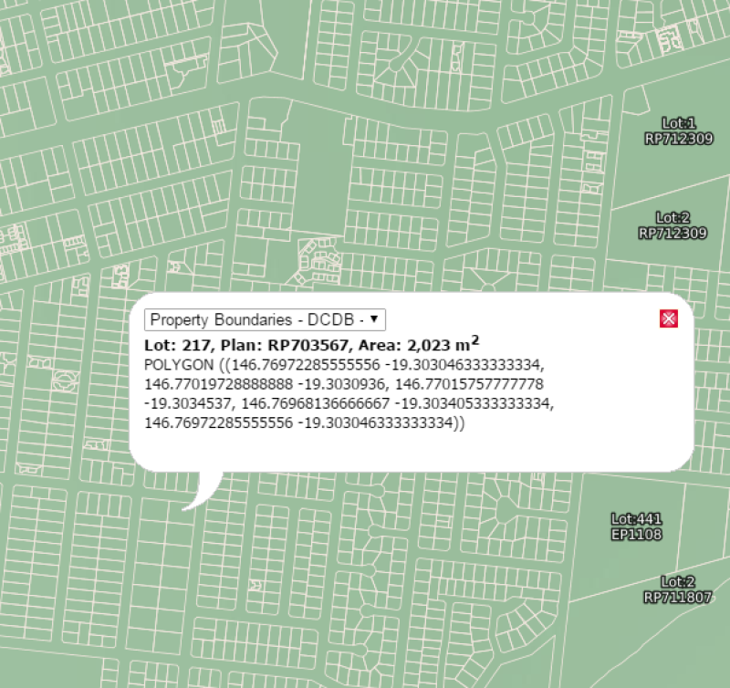
Property boundaries Queensland - DCDB Lite (DNRM)
This polygon layer is a 'lite' version of the Digital Cadastral Database (DCDB) showing minimal attribute data about the property boundaries e.g.: base lot polygons, Lot and Plan attributes and an accuracy statement covering the whole of Queensland. See additional information also.
This data is updated nightly on the QSpatial portal, but only infrequently on the eAtlas. The versions setup on the eAtlas are retained for historic purposes.
This polygon layer is a 'lite' version of the base cadastre in the Digital Cadastral Database (DCDB) showing minimal attribute data about the property boundaries. The dataset does not contain information on volumetric, strata lots, multi level building format lots or secondary interest such as easements and covenants. A complete extract of the state or by an individual local government area is available from the Queensland Spatial Catalogue.
EATLAS: This metadata record was created for the eAtlas and is not authoritative. It is based on a copy of the metadata supplied with the latest version of this dataset. Please contact QSpatial for the original metadata or more information.
Data Dictionary 2023-05-29:
LOT: Examples: 1, 36, 5026
PLAN: Examples: SP232048, RP195536, CA311276, PH251, EI835473
ACC_CODE: Examples: B&D ENTRY CONTROLLED - 0.1M, UPGRADE IMAGERY - 25M, UPGRADE ADJUSTMENT - 1M, STANDARD 1:2500 CADASTRAL MAP - 1.5M
O_SHAPE_Le: Examples: 0.068803813631, 0.00093317039017. eAtlas Note: The units of this attributes is unknown, but it is not the shape perimeter in metres or km.
O_SHAPE_Ar: Examples: 5.0887917895e-08 eAtlas Note: The units of this attributes is unknown, but it is not the shape area in square metres or square km.
Change Log:
- 2012-07-15: Original version setup in the eAtlas
- 2016-08-18: The LOT_AREA attribute is no longer available.
- 2023-05-29: Added a new version of the dataset.
Simple
Identification info
- Alternate title
- Property boundaries - DCDB Lite
- Date (Publication)
- 2016-05-15T00:00:00
- Cited responsible party
-
Role Organisation Name Telephone Delivery point City Administrative area Postal code Country Electronic mail address Custodian Department of Natural Resources and Mines Owner Department of Natural Resources and Mines
- Status
- On going
- Point of contact
-
Role Organisation Name Telephone Delivery point City Administrative area Postal code Country Electronic mail address Point of contact Department of Natural Resources and Mines Voice cadastraladmindatahelp@dnrm.qld.gov.au
- Spatial representation type
- Vector
- Topic category
-
- Planning cadastre
Extent
Extent
))
Temporal extent
- Time period
- 2012 2023
- Maintenance and update frequency
- Daily
Resource format
- Title
- SHP, TAB, GDB or KMZ
- Date
- Edition
- 1
- ANZLIC Search Words
-
- LAND-Cadastre
- common name
-
- cadastre
- land parcels
- cadastral
- digital cadastre database
- DCDB
- property boundaries
- land-cadastre
- cadastral boundaries
- cadastral data
Resource constraints
- Classification
- Unclassified
- Classification system
- Resource Access Level
Resource constraints
- Use limitation
- Version: 2023-05-29: © State of Queensland (Department of Resources) 2023 Version: 2016-08: Copyright State of Queensland (Department of Natural Resources and Mines) 2016
- Use constraints
- Copyright
Resource constraints
- Use limitation
- Version: 2023-05-29: This material is licensed under a Creative Commons - Attribution 4.0 International licence. Creative Commons License The Department of Resources requests attribution in the following manner: © State of Queensland (Department of Resources) 2023. Updated data available at http://qldspatial.information.qld.gov.au/catalogue// Version: 2016-08: This material is licensed under a Creative Commons - Attribution 3.0 Australia licence.<br /> <a rel="license" href="http://creativecommons.org/licenses/by/3.0/au/"><img alt="Creative Commons License" title="Creative Commons - Attribution 3.0 Australia License" style="border: 0;" src="http://i.creativecommons.org/l/by/3.0/au/88x31.png" /></a><br /> The Department of Natural Resources and Mines requests attribution in the following manner: © State of Queensland (Department of Natural Resources and Mines) 2016. Updated data available at http://qldspatial.information.qld.gov.au/catalogue//
- Use constraints
- License
Associated resource
- Date
- Citation identifier
- PROP.QLD_DCDB\PROP.QLD_CADASTRE_DCDB
- Association Type
- source
- Language
- English
- Environment description
- Spatial Information Resource
- Supplemental Information
- This polygon layer is a 'lite' version of the Digital Cadastral Database (DCDB) showing minimal attribute data about the property boundaries e.g.: base lot polygons, Lot and Plan attributes and an accuracy statement covering the whole of Queensland. A complete extract of the DCDB BY LGA is available from the Queensland Spatial Catalogue. The data can be downloaded by searching on "Cadastral Data Queensland by area of interest". From the 30 November 2015, there will no longer be reference to Parishes and Counties in the Departments land information systems, including the Digital Cadastral Database (DCDB) – a computerised map of property boundaries and related description of all land parcels in Queensland. The Department of Natural Resources and Mines will retain a record of parishes and counties for historical purposes. The Museum of Lands, Mapping and Surveying provides historical information about parishes and counties and the historical parish directory is available online. If you obtain information or products from QSpatial, either the information will no longer contain parish and county details, or the parish and county fields will contain the words ‘no longer used’. DISCLAIMER: Users of the information recorded in this document (the Information) accept all responsibility and risk associated with the use of the Information and should seek independent professional advice in relation to dealings with property. Despite the department's best efforts, it makes no representations or warranties in relation to the Information, and, to the extent permitted by law, exclude or limit all warranties relating to correctness, accuracy, reliability, completeness or currency and all liability for any direct, indirect and consequential costs, losses, damages and expenses incurred in any way (including but not limited to that arising from negligence) in connection with any use of or reliance on the Information. EATLAS: This metadata contains additional information associated with eAtlas services for this dataset and historic changes to this dataset. The eAtlas has taken snapshots of the DCDB lite dataset (July 2012, Aug 2016) and made them as map layers. Historic snapshots are available for download by request.
Distribution Information
- Distribution format
-
- Queensland Spatial Catalogue
Distributor
- Distributor contact
-
Role Organisation Name Telephone Delivery point City Administrative area Postal code Country Electronic mail address Resource provider Department of Natural Resources and Mines
- Ordering instructions
- Open the Queensland Spatial Catalogue (QSpatial). Select the large search button and all available records are displayed. Select one of the four filter options provided and then the further options within the filter. The resultant search is then displayed. Select your record and complete the order.
- OnLine resource
- http://qldspatial.information.qld.gov.au/catalogue//
- downloadableData
- Queensland Spatial Catalogue
Distributor
- Distributor contact
-
Role Organisation Name Telephone Delivery point City Administrative area Postal code Country Electronic mail address Distributor Department of Natural Resources and Mines
- Title
- From the Queensland Spatial Catalogue available as ESRI Shape file, MapInfo Tab file, file geodatabase GDB, and Google KMZ
- Date
- Transfer size
- 395
- OnLine resource
- ea:QLD_DNRM_Property-boundaries-DCDB_Aug-2016
- OnLine resource
- Interactive map of this dataset
Data quality info
- Hierarchy level
- Dataset
Report
Result
- Explanation
- New data entered into the Digital Cadastral Database (DCDB) is validated as part of the update process. Each polygon in the DCDB has a unique identifier called a segment-parcel number. The attributes of the polygon based on the centroid which is the segment-parcel number are: accuracy code, lot number, maximum error value and plan number.
Report
Result
- Explanation
- This version of the DCDB can be considered as a seamless map of the State and consists of base cadastral parcels. The Base parcels are contiguous with surrounding base parcels. The graphic package and the routines that extract and reload update data to the database has a tolerance of 2mm on the ground. This tolerance may become significant in some proprietary systems and therefore an allowance will be necessary.
Report
Result
- Explanation
- Positional accuracy values have been allocated to all parcels in the DCDB. This value reflects 'maximum error' status of the parcel and has been derived from the capture process or assigned as the DCDB data has been upgraded. For this extraction, the 'maximum error' of parcels, expressed as a value, ranges from and a data sourced statement. It has been established that the positional accuracy of the DCDB should include a finite value representing the 'maximum error' based on the source map type, the scale and a digitising value component. Positional accuracy values are expressed in metres at a 95% confidence level.
Report
Result
- Explanation
- The attributes in the DCDB are acquired from a number of sources within the Department. The attributes describe the property description ( Lot on Plan ) of each parcel/polygon. Each polygon in the DCDB has a unique identifier called a segment-parcel number. The following attributes are attached to each polygon in the DCDB based on the polygon centroid which is the segment-parcel number: Accuracy code , Lot number , Maximum error value, Plan number. The original validation process consisted of the visual inspection and or comparison of hard copy output compared to the departmental cadastral working maps and update plans. There are several system validation procedures in the maintenance process and these are run at a required frequency. The QIF data routine also provides a validation report on a data extract. The estimated accuracy of the attribute information is 98%.
Resource lineage
- Statement
- The attributes in the DCDB are acquired from a number of sources within the Department. The attributes describe the property description ( Lot on Plan ) of each parcel/polygon. Each polygon in the DCDB has a unique identifier called a segment-parcel number. The following attributes are attached to each polygon in the DCDB based on the polygon centroid which is the segment-parcel number: Accuracy code , Lot number , Maximum error value, Plan number. The validation process consisted of the visual inspection and or comparison of hard copy output compared to the departmental cadastral working maps and update plans. There are several system validation procedures in the maintenance process and these are run at a required frequency. The QIF data routine also provides a validation report on a data extract. The estimated accuracy of the attribute information is 98%.
- Hierarchy level
- Dataset
Process step
- Description
- The DCDB data, in DCDB transfer format (IFO), is FTP'd to the Spatial Information Resource server every night where it is transformed into the Spatial Information Resource (SIR) ArcSDE Geodatabase.
Reference System Information
- Reference system identifier
- EPSG:4938
- Title
- EPSG Geodetic Parameter Dataset
- Date (Revision)
- 2007-07-16T00:00:00
- Edition
- Version 6.13
Metadata constraints
- Use limitation
- Public
- Classification
- Unclassified
- Classification system
- Metadata Access Level
Metadata
- Metadata identifier
- urn:uuid/a86f062e-f47c-49f1-ace5-3e03a2272088
- Language
- English
- Character encoding
- UTF8
- Contact
-
Role Organisation Name Telephone Delivery point City Administrative area Postal code Country Electronic mail address Point of contact Department of Natural Resources and Mines Voice GPO Box 2454 Brisbane QLD 4000 Australia cadastraladmindatahelp@dnrm.qld.gov.au
Type of resource
- Resource scope
- Dataset
- Date info (Revision)
- 2026-02-19T02:53:37.638Z
- Date info (Creation)
- 2021-01-25T04:59:24
Metadata standard
- Title
- ISO 19115-3:2018