eAtlas Data Catalogue
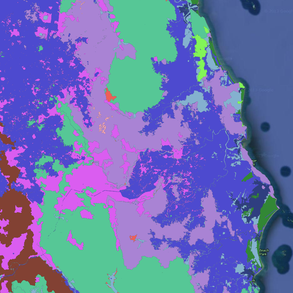
Geology of the Wet Tropics Bioregion (WTMA)
This dataset contains polygons depicting geology as deliniated by botanist J.P.Stanton and geologist D.J.Stanton within the Wet Tropics bioregion.
The geology mapping of the Wet Tropics Bioregion is based on interpretation of aerial photographs during WTMAs Vegetation of the Wet Tropics of Queensland bioregion mapping project. Aerial photography was also used to select sites and traverses for ground truthing work. The geological classification and boundaries were based on their relevence to vegetation patterns.
The dataset has been derived from 1:25,000 aerial photography. Botanists J.P.Stanton and geologist D.J.Stanton deliniated vegetation and geology types by manually drawing polygons directly onto the aerial photography. Field verification was also undertaken. Aerial photographs were scanned and authorectified to WTMAs 50k river dataset using an 80m digital elevation model (DEM). Linework was extracted digitally from the rectified photography and attributes added manually.
This dataset covers the entire Wet Tropics bioregion.
*Positional accuracy*
Accuracy is estimated at +/- 12m from true position as depicted on the Australian 1:50,000 Topographic Survey Map Series R733.
*Attribute accuracy*
Attribute accuracy is estimated at 95%.
*Citation*
Wet Tropics Management Authority (2013). Geology of the Wet Tropics Bioregion of Queensland. Wet Tropics Management Authority, Cairns.
/Base data/Data reproduced with permission of Wet Tropics Management Authority/
This metadata was prepared for the eAtlas and is not authoritative. Please contact the Wet Tropics Management Authority for an authoritative record.
Simple
Identification info
- Date (Publication)
- 2013-12-01T10:43:00
- Status
- Completed
- Point of contact
-
Role Organisation Name Telephone Delivery point City Administrative area Postal code Country Electronic mail address Point of contact Wet Tropics Management Authority Voice facsimile Ground floor, Cairns Port Authority, Cnr Grafton and Hartley StreetPO Box 2050 CAIRNS Queensland 4870 Australia wtma.records@epa.qld.gov.au
- Topic category
-
- Biota
Extent
Extent
))
Resource constraints
- Use limitation
- Wet Tropics Management Authority
- Use constraints
- Copyright
Resource constraints
- Use limitation
- This dataset was made available to the eAtlas from WTMA under a restrictive non-commercial license. This license has restrictions to: a) not make the data available to a third party by sale or otherwise; and b) not sell products derived from the data; and c) not use the data to cause substantial distortion to normal competitive arrangements; and d) not use the data to derive income or gain a financial return. The full license is stored with the datasets. Base data/Data reproduced with permission of Wet Tropics Management Authority.
- Use constraints
- License
- Language
- English
- Character encoding
- UTF8
Distribution Information
- Distribution format
-
- OnLine resource
- wtma:WT_WTMA_WTMaps-2008_Geology
- OnLine resource
- Interactive map of this dataset
- OnLine resource
- eAtlas Web Mapping Service (WMS) (AIMS)
Resource lineage
- Hierarchy level
- Dataset
Reference System Information
Identifier
- Codespace
- EPSG
Metadata
- Metadata identifier
- ae0c35a4-8b42-4119-8c65-f8b978ad3ba5
- Language
- English
- Character encoding
- UTF8
- Contact
-
Role Organisation Name Telephone Delivery point City Administrative area Postal code Country Electronic mail address Point of contact Australian Institute of Marine Science (AIMS) Lawrey, Eric, Dr. Voice facsimile PRIVATE MAIL BAG 3, TOWNSVILLE MAIL CENTRE Townsville Queensland 4810 Australia e-atlas@aims.gov.au
Type of resource
- Resource scope
- Dataset
- Metadata linkage
-
https://eatlas.org.au/data/uuid/ae0c35a4-8b42-4119-8c65-f8b978ad3ba5
Point of truth URL of this metadata record
- Date info (Creation)
- 2014-09-03T00:00:18
- Date info (Revision)
- 2014-09-03T00:00:18
Metadata standard
- Title
- ISO 19115-3:2018