eAtlas Data Catalogue
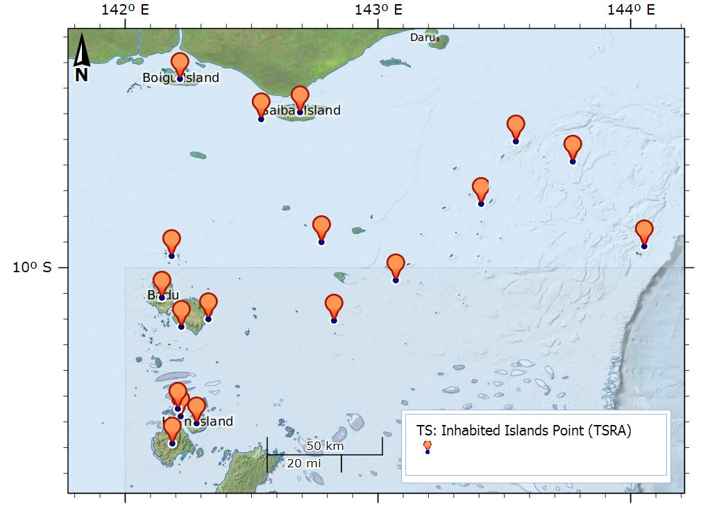
Torres Strait Inhabited Islands (TSRA)
This dataset shows the point location of communities on Torres Strait Islands. There are 18 Islands in the Torres Strait and 19 Communities. St Pauls and Kubin villages are both located on Moa Island. Each point includes an URL attribute pointing to the community pages on the TSRA website. The Island Communities are:
Boigu Island, Warraber Island, Ugar Island, Thursday Island, Saibai Island, Poruma Island, Prince of Wales Island, Mer Island, Masig Island, Mabuiag Island, Iama Island, Horn Island, Hammond Island, Erub Island, Dauan Island, Badu Island, St Pauls, Moa Island, Kubin, Moa Island
The dataset is a point shapefile, created in ArcGIS Version 10.0.
Data Dictionary:
- URL: URL to the community page for the island on the TSRA website.
- Region: Region within Torres Strait (Northern islands, Central islands, Eastern islands, Southern islands, Western islands) from the Torres Strait Island Regional Council.
- Pop2011: Population of each island from the 2011 census.
Data Location:
This dataset is filed in the eAtlas enduring data repository at: data\TSRA\TS_TSRA_Inhabited-Islands_2014
Change Log:
- V2 21-03-2016 (Eric Lawrey, AIMS): Added Regions and population statistics.
Simple
Identification info
- Date (Publication)
- 2015-01-01
- Date (Revision)
- 2016-03-21T00:00:00
- Status
- Completed
- Point of contact
-
Role Organisation Name Telephone Delivery point City Administrative area Postal code Country Electronic mail address Point of contact Torres Strait Regional Authority (TSRA) Stewart, Melanie Voice Facsimile Level 4, 38 Sheridan St Cairns Queensland 4870 Australia Melanie.STEWART@tsra.gov.au
- Spatial representation type
- Vector
Spatial resolution
Equivalent scale
- Denominator
- 100000
- Topic category
-
- Location
Extent
Extent
))
- Keywords (Theme)
-
- Human Dimensions | Population | Population Distribution
- marine
Resource constraints
- Linkage
-
http://i.creativecommons.org/l/by/3.0/au/88x31.png
License Graphic
- Title
- Creative Commons Attribution 3.0 Australia License
- Cited responsible party
-
Role Organisation Name Telephone Delivery point City Administrative area Postal code Country Electronic mail address
- Website
-
http://creativecommons.org/licenses/by/3.0/au/
License Text
- Language
- English
- Character encoding
- UTF8
Distribution Information
- OnLine resource
- eAtlas Web Mapping Service (WMS) (AIMS)
- OnLine resource
- tsra:TS_TSRA_Inhabited-Islands_2014
- OnLine resource
- Inhabited islands shapefile V2 [zip 4 kB]
- OnLine resource
- Torres Strait Regional Council (General location and Map)
- OnLine resource
- 2011 Census Quick Stats for Torres Strait.
Reference System Information
- Reference system identifier
- EPSG/EPSG:4283
Metadata
- Metadata identifier
- urn:uuid/b4ddc121-0edf-42de-b2ec-fcfb044578ca
- Language
- English
- Character encoding
- UTF8
- Contact
-
Role Organisation Name Telephone Delivery point City Administrative area Postal code Country Electronic mail address Point of contact Torres Strait Regional Authority (TSRA) Stewart, Melanie Voice Facsimile Level 4, 38 Sheridan St Cairns Queensland 4870 Australia Melanie.STEWART@tsra.gov.au
Type of resource
- Resource scope
- Dataset
- Metadata linkage
-
https://eatlas.org.au/data/uuid/b4ddc121-0edf-42de-b2ec-fcfb044578ca
Point of truth URL of this metadata record
- Date info (Creation)
- 2016-08-02T15:41:42
- Date info (Revision)
- 2023-09-18T07:58:19
Metadata standard
- Title
- ISO 19115-3:2018