eAtlas Data Catalogue
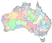
Australia's River Basins 1997 (GA)
Australia's River Basins 1997 is the result of a joint State, Territory and Commonwealth Government project to create a national spatial database of major hydrological basins. It shows the boundaries of Australia's basins as defined by the Australian Water Resources Management Committee (WRMC).
Australia is divided into drainage divisions which are sub-divided into water regions which are in-turn sub-divided into river basins. The data includes the name and number of each of the 245 drainage basins, 77 regions, and 12 divisions.
This metadata was prepared for the eAtlas and is not authoritative. Please contact the custodian for an authoritative record.
Data Location:
A copy of this dataset is filed in the eAtlas enduring data repository at: data\other\AU_GA_River-basins-1997
Simple
Identification info
- Date (Publication)
- 2004-01-01T00:00:00
- Date (Creation)
- 1997-06-01T00:00:00
- Cited responsible party
-
Role Organisation Name Telephone Delivery point City Administrative area Postal code Country Electronic mail address Distributor Geoscience Australia (GA)
- Status
- Completed
- Point of contact
-
Role Organisation Name Telephone Delivery point City Administrative area Postal code Country Electronic mail address Point of contact Geoscience Australia (GA) Voice Facsimile Cnr Jerrabomberra Ave and Hindmarsh Dr Canberra ACT 2601 Australia sales@ga.gov.au
- Spatial representation type
- Vector
Spatial resolution
Equivalent scale
- Denominator
- 250000
- Topic category
-
- Boundaries
Extent
Extent
- Description
- Australia
))
Temporal extent
- Time position
- 1997-06-30T00:00:00
- anzlic-theme
-
- BOUNDARIES
- WATER Hydrology
- Keywords (Theme)
-
- GIS
- National dataset
- environmental
- hydrology
- mapping
- catchments
Resource constraints
- Linkage
-
http://i.creativecommons.org/l/by/3.0/au/88x31.png
License Graphic
- Title
- Creative Commons Attribution 3.0 Australia License
- Cited responsible party
-
Role Organisation Name Telephone Delivery point City Administrative area Postal code Country Electronic mail address
- Website
-
http://creativecommons.org/licenses/by/3.0/au/
License Text
- Language
- English
- Character encoding
- UTF8
- Supplemental Information
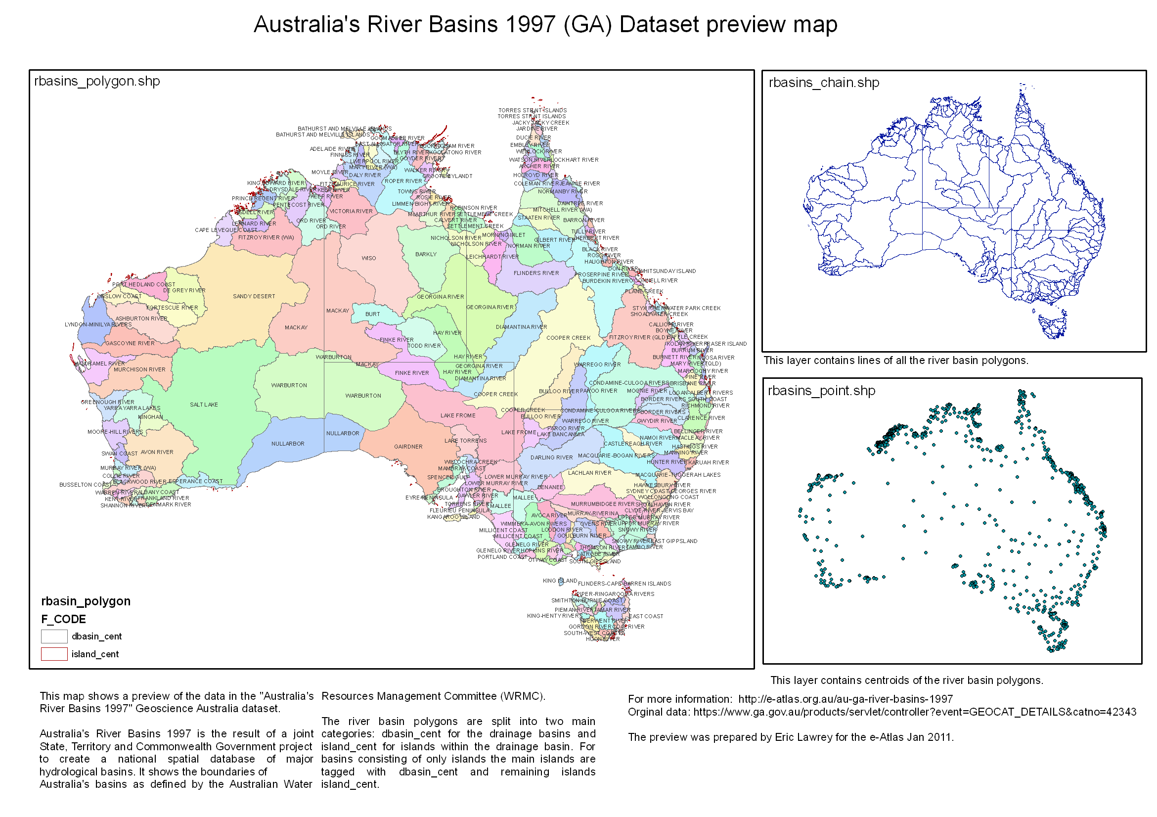
- rbasin_polygon.shp (13.2 MB, 1302 polygons, Datum: AGD66): This shapefile contains the boundaries of all the major river basins of Australia. Where a river basin includes islands, the islands carry the same attributes, except for the feature code (F_CODE) which is set to "island_cent" instead of "dbasin_cent". There are 288 dbasin_cent features and 1014 island_cent features. rbasin_chain.shp (9 MB, 2627 lines, Datum: AGD66): This shapefile contains the outlines of the river basins. rbasin_point.shp (320 kB, 1302 points, Datum AGD66): Centroid of each river basin polygon. Available for download from GA in the following zipped formats: ArcView shape file, May be imported into MapInfo, 12.81MB, MapInfo Interchange Format (MIF), 9.38MB
Distribution Information
- Distribution format
-
- DIGITAL - mif MapInfo Interchange Format (MIF) MapInfo Geographic AGD66
- DIGITAL - shp ArcView shape file ArcView Geographic AGD66
- DIGITAL - mif MapInfo Interchange Format (MIF) MapInfo Geographic AGD66
- DIGITAL - shp ArcView shape file ArcView Geographic AGD66
- OnLine resource
- Australia's River Basins 1997, Geoscience Australia, Free data download page [Shapefile and PDF] and original metadata.
- OnLine resource
- ea:AU_GA_River-basins-1997
- OnLine resource
- eAtlas Web Mapping Service (WMS) (AIMS)
Resource lineage
- Statement
- Data for basin boundaries have been captured by relevant State and Territory authorities from 1:10 000 and 1:250 000 scale source material. The balance of the data are from Geoscience Australia's GEODATA Coast 100K which includes coastlines and State and Territory borders. Australia's River Basin data complies with the following rules for topology: - The data has a node/chain structure; - Every line feature has a node at each end; - Every line feature has a node at intersections; - Every line feature has a node at the point where an attribute of the feature changes; - There are no unnecessary pseudo nodes; - Every polygon is closed; - Every polygon contains a polygon label point; - There are no coincident features; - There are no undershoots, overshoots, broken lines or other artefacts; - Divisions, Regions or Basins that are intersected by State borders have identical label point attributes each side of the State border; and - Lines intersected by State borders, except for coastline, have identical attributes.
- Hierarchy level
- Dataset
Reference System Information
- Reference system identifier
- EPSG/EPSG:4202
Metadata
- Metadata identifier
- urn:uuid/ea0a81fd-c864-4035-b51a-e214fa0a57b4
- Language
- English
- Character encoding
- UTF8
- Contact
-
Role Organisation Name Telephone Delivery point City Administrative area Postal code Country Electronic mail address Point of contact Australian Institute of Marine Science (AIMS) eAtlas Data Manager Voice Facsimile PRIVATE MAIL BAG 3, TOWNSVILLE MAIL CENTRE Townsville Queensland 4810 Australia e-atlas@aims.gov.au
Type of resource
- Resource scope
- Dataset
- Metadata linkage
-
https://eatlas.org.au/data/uuid/ea0a81fd-c864-4035-b51a-e214fa0a57b4
Point of truth URL of this metadata record
- Date info (Creation)
- 2019-10-30T05:46:10
- Date info (Revision)
- 2023-09-18T06:54:07
Metadata standard
- Title
- ISO 19115-3:2018