eAtlas Data Catalogue
eAtlas Web Mapping Service (WMS) - Legacy MTSRF Server (AIMS)
The eAtlas delivers its mapping products via two Web Mapping Services, a legacy server (from 2008-2011) and a newer primary server (2011+) to which all new content it added. This record describes the legacy WMS. This service was decommissioned on in Jan 2024.
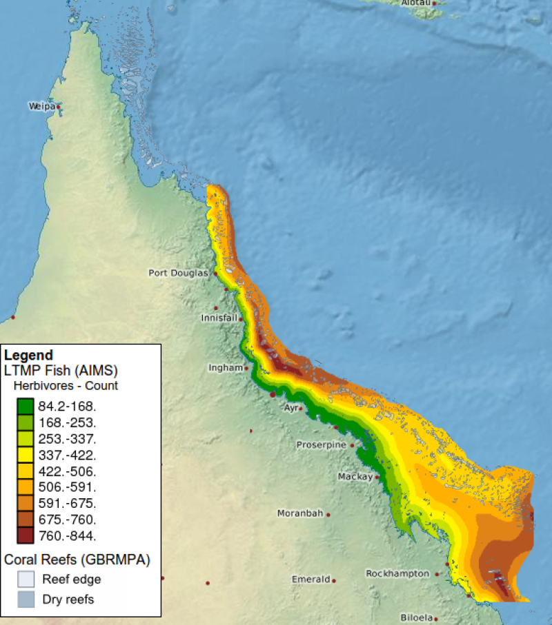
This service delivered map layers associated with the eAtlas project ( https://eatlas.org.au ), and contained map layers of environmental research focusing on the Great Barrier Reef. The majority of the layers corresponding to Glenn De'ath's interpolated maps of the GBR developed under the MTSRF program (2008-2010).
This web map service was predominantly maintained for the no decommissioned legacy eAtlas map viewer ( https://maps.eatlas.org.au/geoserver/www/map.html ).
This WMS service was implemented using GeoServer version 1.7 software hosted on a server at the Australian Institute of Marine Science.
Note: this service had around 460 layers of which approximately half the layers correspond to Standard Error maps, which were WRONG (please ignore all *Std_Error layers).
This services was operated by the Australian Institute of Marine Science and co-funded by the MTSRF program.
More details about this service is described on the eAtlas Legacy System webpage https://eatlas.org.au/content/legacy-mapping-system
Simple
Identification info
- Date (Publication)
- 2008-11-01T11:47:00
- Status
- Deprecated
- Point of contact
-
Role Organisation Name Telephone Delivery point City Administrative area Postal code Country Electronic mail address Point of contact Australian Institute of Marine Science (AIMS) Lawrey, Eric, Dr Voice PRIVATE MAIL BAG 3, TOWNSVILLE MAIL CENTRE Townsville Queensland 4810 Australia e-atlas@aims.gov.au
- Spatial representation type
- Grid
- Topic category
-
- Biota
- Boundaries
- Elevation
- Planning cadastre
- Imagery base maps earth cover
Extent
Extent
))
- Keywords (Theme)
-
- Web Mapping Service
- WMS
- GeoServer
Resource constraints
- Use limitation
- The imagery provided by this service is made available under a creative commons license. Attribution should be given to the eAtlas and the data providers of the layers. This layer information is available via the titles and the linked metadata records. If you use this service in an on-going service like a portal please send us an email so we can inform you of any potential changes to the service.
- Linkage
-
http://i.creativecommons.org/l/by/2.5/au/88x31.png
License Graphic
- Title
- Creative Commons Attribution 2.5 Australia License
- Cited responsible party
-
Role Organisation Name Telephone Delivery point City Administrative area Postal code Country Electronic mail address
- Website
-
http://creativecommons.org/licenses/by/2.5/au/
License Text
- Language
- English
- Character encoding
- UTF8
Distribution Information
- OnLine resource
- Welcome page for the legacy eAtlas GeoServer WMS. From here you can find all service capabilities and layer previews
- OnLine resource
- Historic link to legacy eAtlas mapping portal. This is now decommissioned and broken.
- OnLine resource
- Video documenting the service prior to decommissioning
Reference System Information
- Reference system identifier
- EPSG/EPSG:4326
Metadata constraints
- Linkage
-
http://i.creativecommons.org/l/by/2.5/au/88x31.png
License Graphic
- Title
- Creative Commons Attribution 2.5 Australia License
- Cited responsible party
-
Role Organisation Name Telephone Delivery point City Administrative area Postal code Country Electronic mail address
- Website
-
http://creativecommons.org/licenses/by/2.5/au/
License Text
Metadata
- Metadata identifier
- urn:uuid/b0cba902-4e15-4d23-a568-e7cd4b201aac
- Language
- English
- Character encoding
- UTF8
- Contact
-
Role Organisation Name Telephone Delivery point City Administrative area Postal code Country Electronic mail address Point of contact Australian Institute of Marine Science (AIMS) Lawrey, Eric, Dr Voice facsimile PRIVATE MAIL BAG 3, TOWNSVILLE MAIL CENTRE Townsville Queensland 4810 Australia e-atlas@aims.gov.au
- Parent metadata
Type of resource
- Resource scope
- Service
- Metadata linkage
-
https://eatlas.org.au/data/uuid/b0cba902-4e15-4d23-a568-e7cd4b201aac
Point of truth URL of this metadata record
- Date info (Creation)
- 2015-02-05T14:21:06
- Date info (Revision)
- 2024-02-01T10:57:39
Metadata standard
- Title
- ISO 19115-3:2018